Leadmine Trails – Sturbridge

These Saturday hikes are becoming a bit of a tradition, as our daughter spends a few hours in gymnastics and we explore our surroundings one trail at a time.

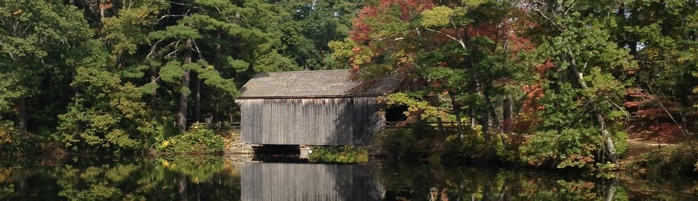
On this Saturday we returned to Leadmine Road, where we had previously parked to explore the Heins Farm property.  This time, though, we descended onto the trails which explore the Leadmine conservation area which borders Old Sturbridge Village.  A trail map can be seen on the Friends of Sturbridge Trails website.

Looking at that map, we basically followed the red trail until it met the blue trail, and then the blue trail until it returned to the red.  We covered a bit over 3 miles on those two trails.  The FrOST team has done a great job marking these trails, but there are some mismatches between the trail blazes and the colors on the map.  Modern life has certainly spoiled us; we took a picture of the trail map at the kiosk, and cross-referenced it with our GPS apps to make sure we were on the right track.

cropped-004.jpg

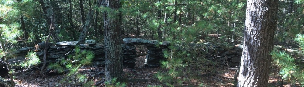
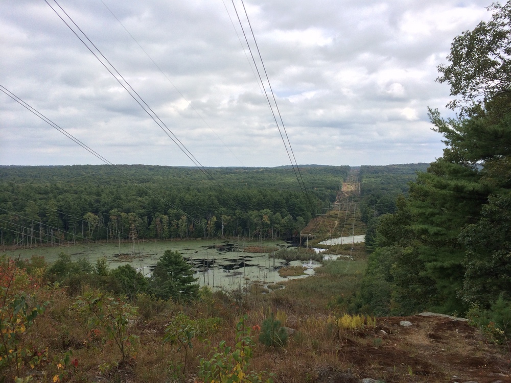
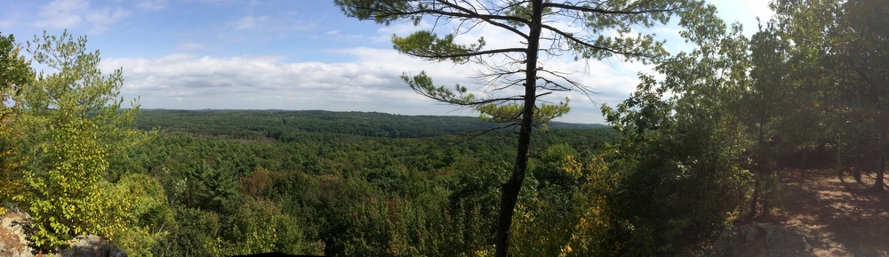
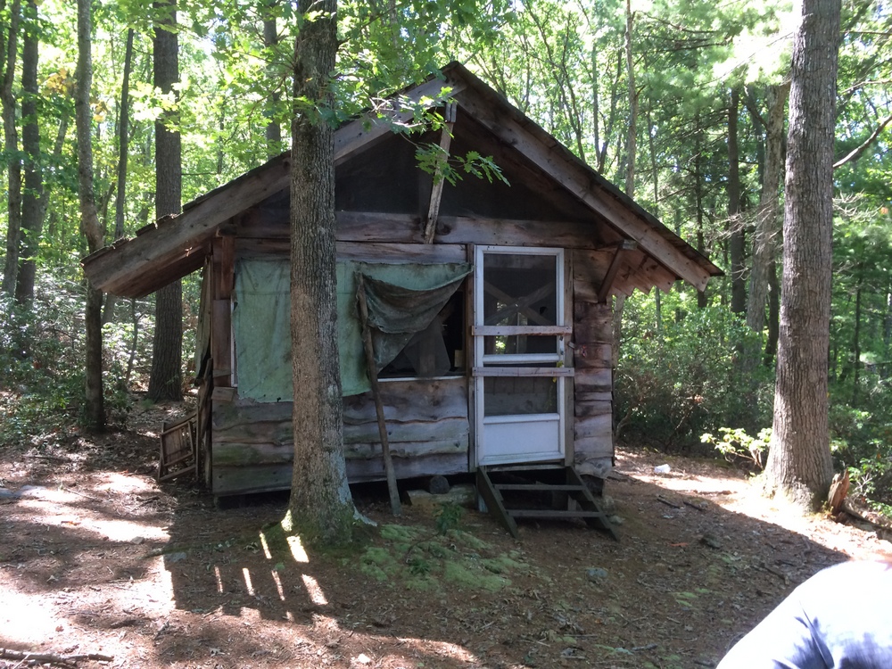
The trail is moderately hilly but nothing too difficult.  The area is open to hunting in season, unlike the Heins property across the street.  The area has an interesting history, as it used to contain a mine used to extract graphite for pencil lead.  If you explore the right areas you can find evidence of the old mines, but we didn’t make it that far.

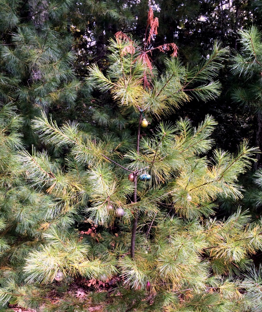
Definitely a place we’ll return to, to explore further.  There are some geocaches hiding in here too — we found a couple but stopped looking when our network reception got spotty.

Old Sturbridge Village

My wife and I had a babysitter lined up for Tuesday night and decided to go for a quick walk before our dinner out (at our favorite local restaurant Cedar Street Grille).  She knew just what to suggest – a quick lap around her walking trail at Old Sturbridge Village.  She comes here on a regular basis with her best friend and was curious how many miles she was actually burning on each lap.  MapMyHike in hand, we took a quick tour and learned it was a 1.44 mile loop, rather than the “about a mile” she was assuming before.

cropped-587.jpg

It’s a quick and pretty walk through the grounds.  As members, dropping in for a little exercise is no big deal.  From the entrance, head towards the common, and then bank right after the Center Meetinghouse and loop up into the woods and then back down to the Freeman farm.  Cut through the fields below the farm and come back out by the Gristmill.  Detour out to the Quinebaug bridge and then follow the river back to the Vermont bridge before coming back to the Common.  Go past the Printer and hang left back towards the Visitor Center.

Repeat as needed and time allows!  Here’s a map of the property if you want to try it yourself…

Westville Dam – Sturbridge and Southbridge

A surprise hike took us to Westville Dam today with a friend and his family (after gorging on a breakfast buffet in honor of his 37th birthday).  There were six of us who burned off the breakfast calories at a recreational area which I’d previously done some biking at.

We did a three mile loop which starts at the parking area, follows a rail trail’s wide easy grade, then crosses a dam and follows some steep peaks and valleys before looping back.  The trail crosses between Sturbridge and Southbridge and follows along a recreational area where people picnic in the summer months.  It also borders a popular spring fly-fishing location (noted for later…).

During this impromptu hike we introduced our friends to geocaching.  There were four caches hidden along the trail we followed, and we found all four.  They ranged from large ammo boxes to tiny bison tubes. The smallest cache was fairly challenging, but we finally figured out the hint and walked away victorious.

It was a nice easy hike with frequent pauses to search areas just off the beaten path.  We saw a tiny snake and enjoyed the company of friends.  There’s very little sense of “wilderness” here as compared to Wells State Park, or most recent hike, but it was a much more kid-friendly destination.

Wells State Park – Sturbridge

Our lovely daughter has a gymnastics class that takes up a few hours mid-day on Saturday.  Even after pausing for lunch, we still have some time to get in a hike (or run some errands, or clean the house, but you know, hiking makes for more interesting blog posts), which is what we did on this day.

We’ve explored Wells State Park a few times since we moved out here, but we hadn’t been in a few years.  You can check out the trail map on the state web page here.

We parked at the visitor lot, and started with a brief loop around the heart-healthy Mill Pond Trail.  This is an easy mile, designed to be accessible to everyone.  It warmed us up for the remainder of the hike.

We then switched gears and took the North Trail, a 2.3 mile trek over some rougher terrain and moderate hills that gave our legs quite the workout.  We paused a few times, including a moment looking out where the power lines crossed overhead and filled the air with an audible and disconcerting hum.

018

Not far from here we saw a decorated pine someone had decided needed some Christmas ornamentation.  We snapped a couple shots and continued.

022

We stepped off the North Trail and took a detour over to Carpenters Rocks, with its views out over Sturbridge.  We paused and drained the rest of our water before making the return hike to the car.

023

Overall we were on the trail for about 3.5 miles, over some pretty rugged terrain.  A great hike and there are more trails to explore on the property.  We’ll definitely be back.


Heins Farm – Sturbridge

Today, I took the day off from work to spend with my wife, celebrating her birthday (which was earlier this week).  While our daughter spent the day at school, we went on a mid-day hike exploring the Heins Farm property in Sturbridge, MA.  You can see a trail map at the Friends of Sturbridge Trails site.

It’s a beautiful property close to Old Sturbridge Village.  There’s a trail designed for accessibility (The Pond Loop, 0.7 miles) as well as another 2.3 miles of trails in a variety of terrain from wooded to wild fields.  We hiked the majority of the trails at an easy pace and would recommend this trail to all skill levels.  It was quiet but only a stone’s throw from OSV and Route 20, making it a quick retreat close to home.

We started with the Pond Loop, which is half on one side of Leadmine Road, and half on the other.  The trail is clearly marked, wide, and gentle in terms of grade, surrounded by trees.  On one side of the road, laminated children’s book pages have been attached to the trees making for an interesting diversion for the little ones (our little one was already happily diverted by school, of course).  On the other side of the road, the trail passes a small pond (with a bench for enjoying the view and the birds) before meeting up with the other trails on the property or returning to the parking area.

002

After exploring the Pond Loop, we moved to the Cabin Loop (home of a spooky old cabin) and the Stafford Turnpike Trail.  The Cabin Loop is similar to the Pond Loop but narrower and steeper in grade.  The Stafford Turnpike Trail has a wider variety of terrain including open fields (where wasps had taken over the birdhouses, as far as we could tell; we moved on).

005

We found one geocache (by the pond) but didn’t sign the log (no pen!); there are others in this area as well, including a night cache (we found some obvious markings leading towards this but didn’t pursue them).  I’m not sure I want to see that cabin at night, for what it’s worth….